Situated about 40 miles from Tumut on the Snowy Mountains Highway.

Les
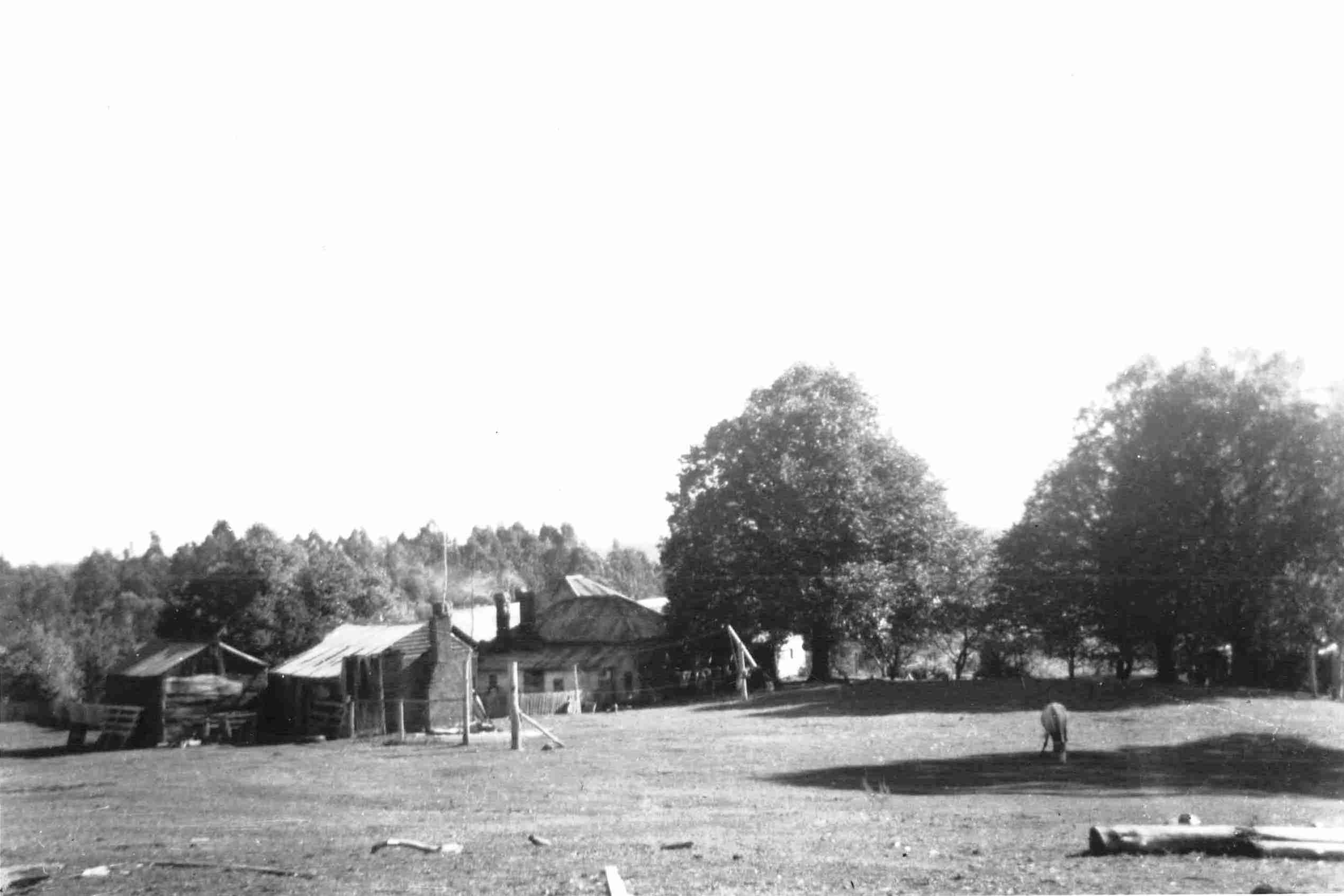
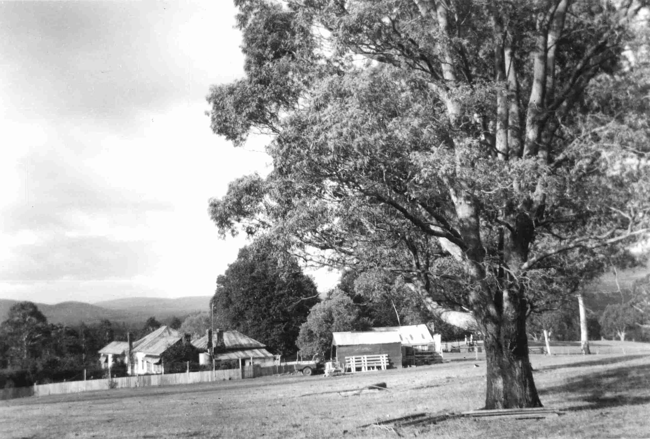
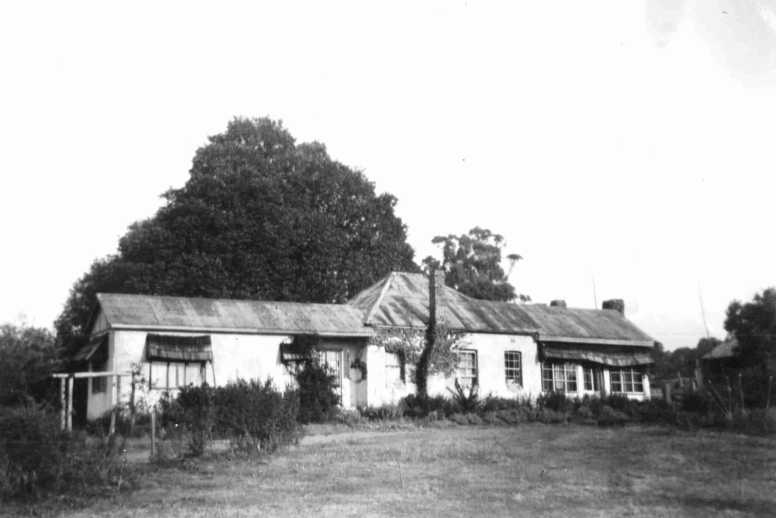
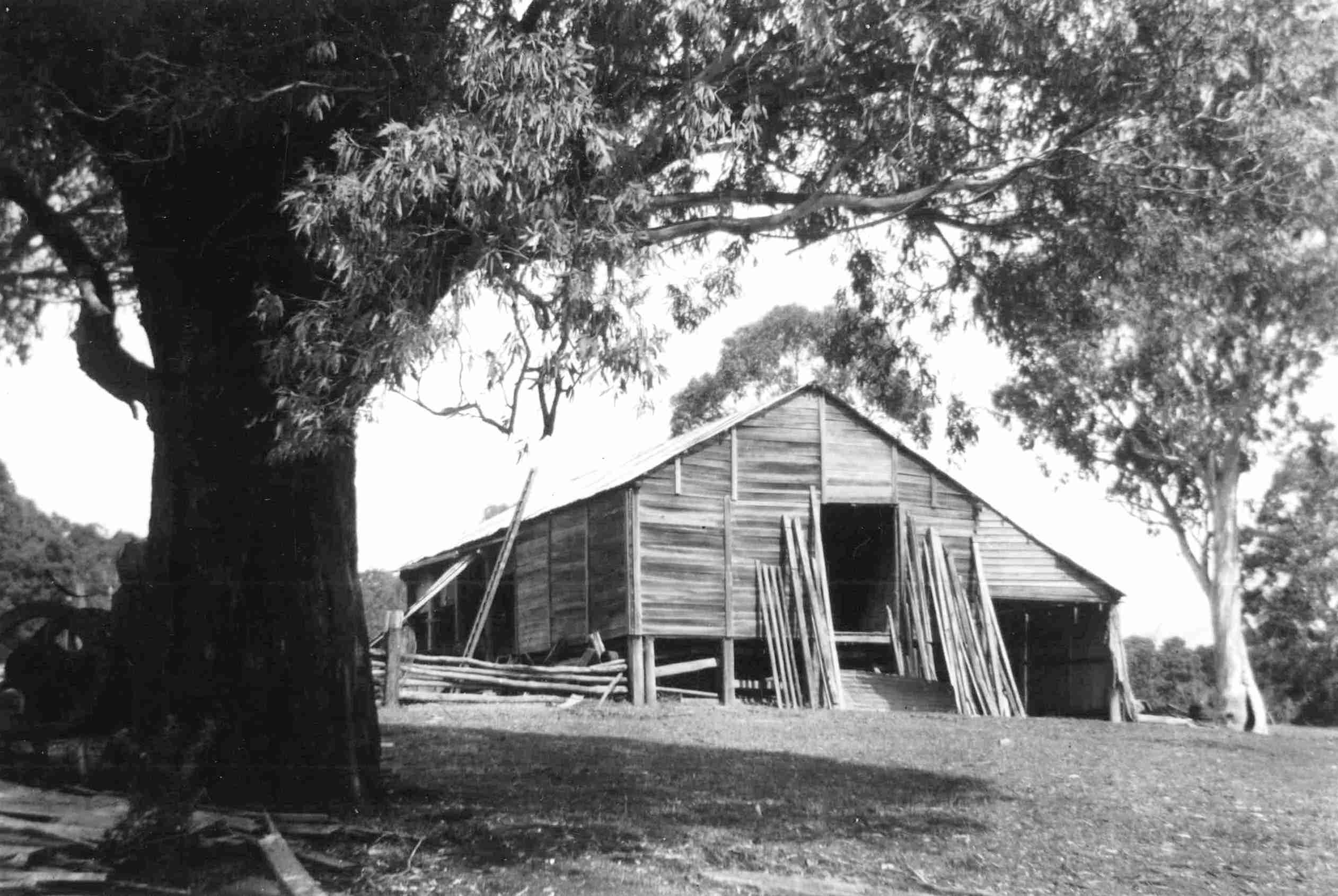
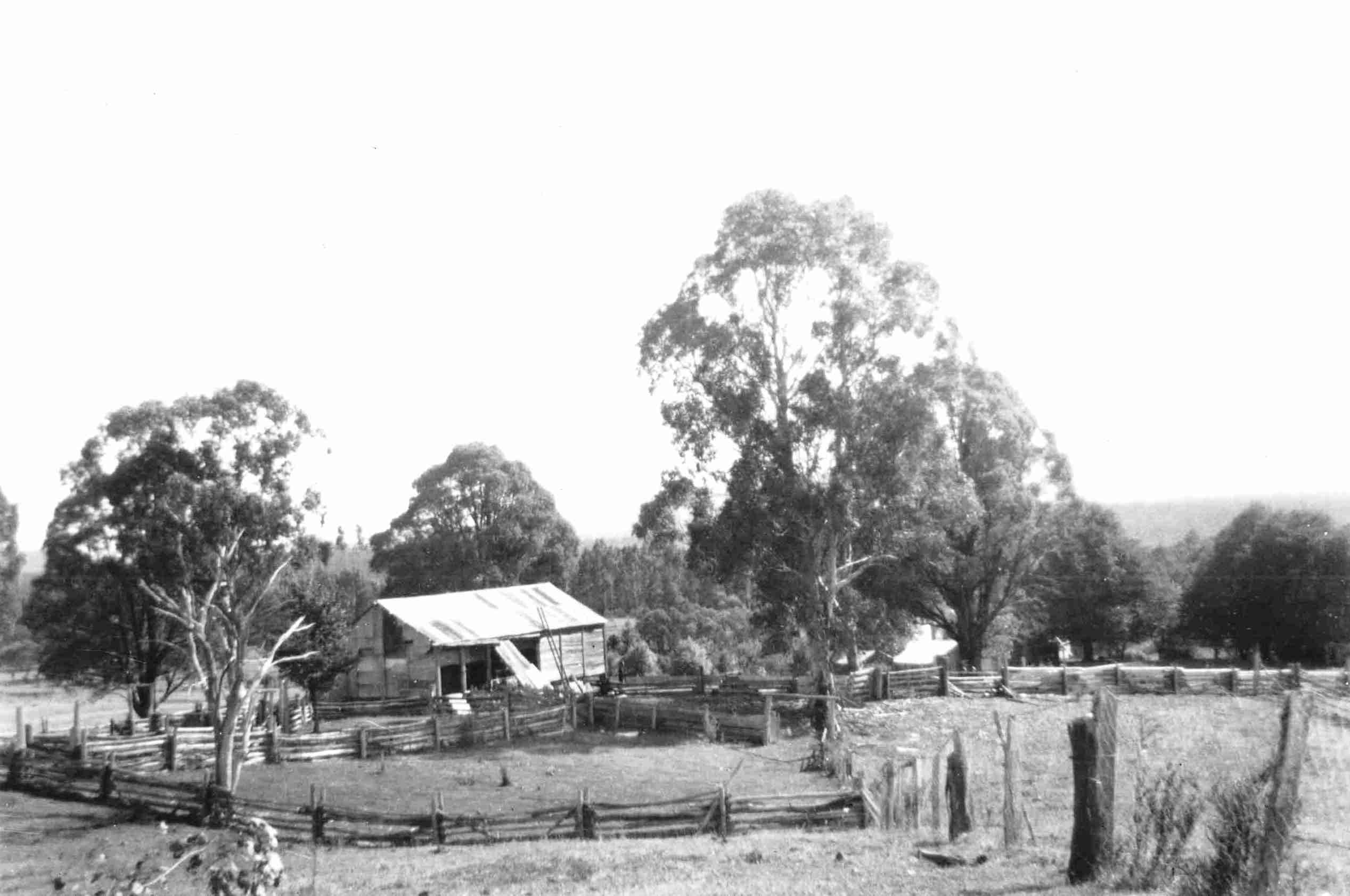
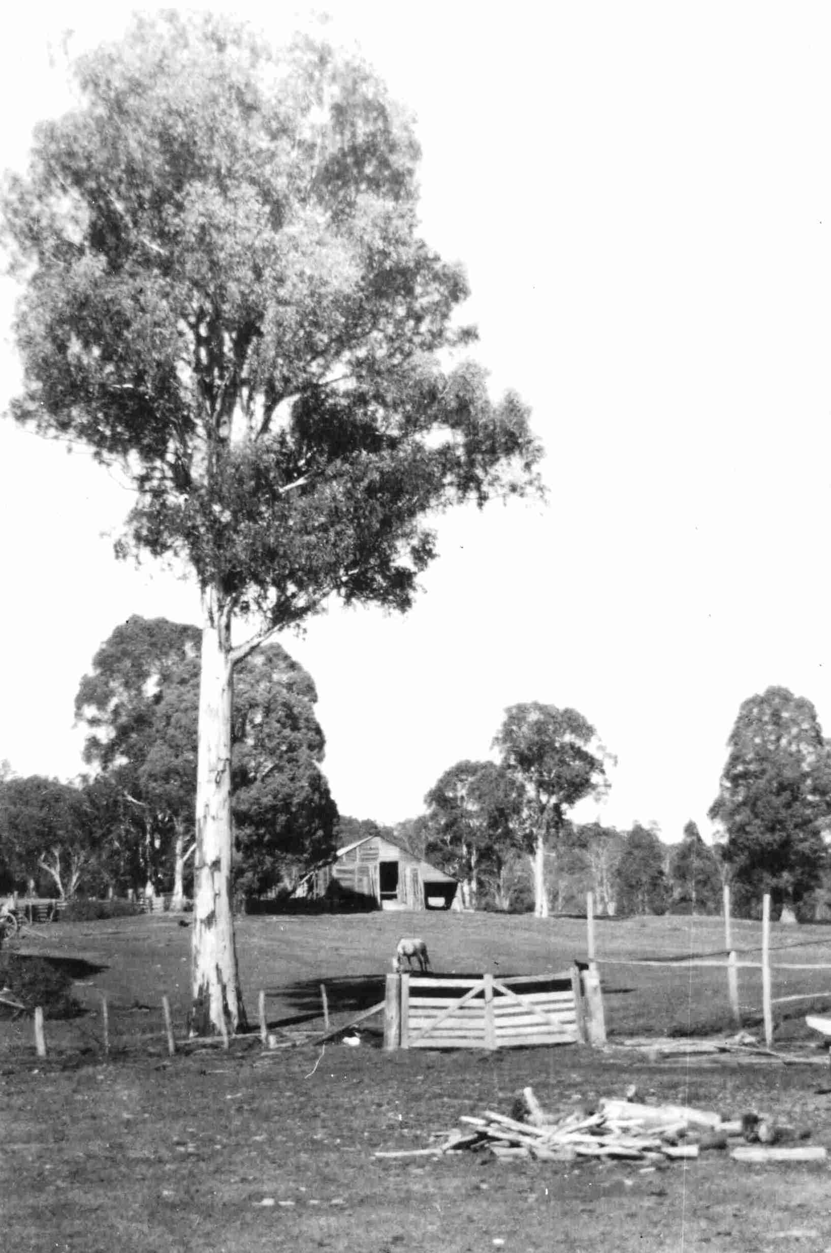
"Jounama Station"
Yarrangobilly. NSW
Snow Lease.
Situated about 40 miles from Tumut on the Snowy Mountains Highway.
Les
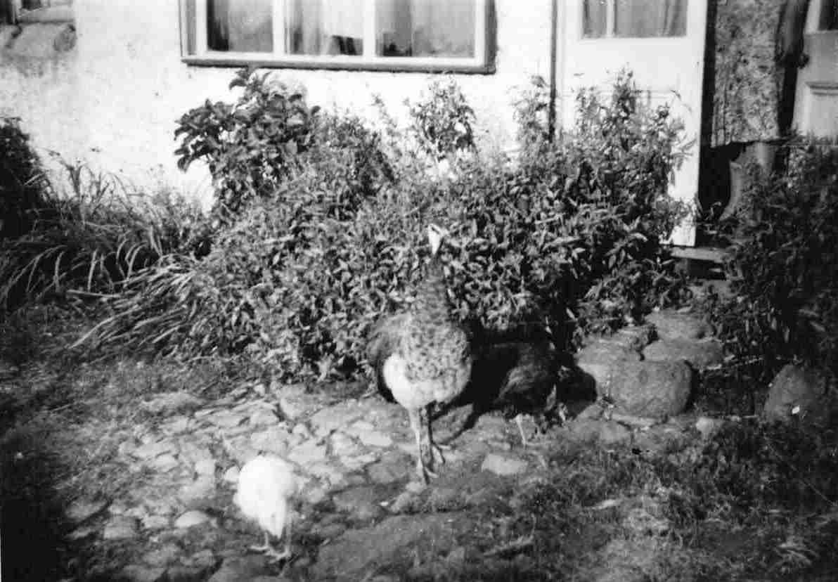
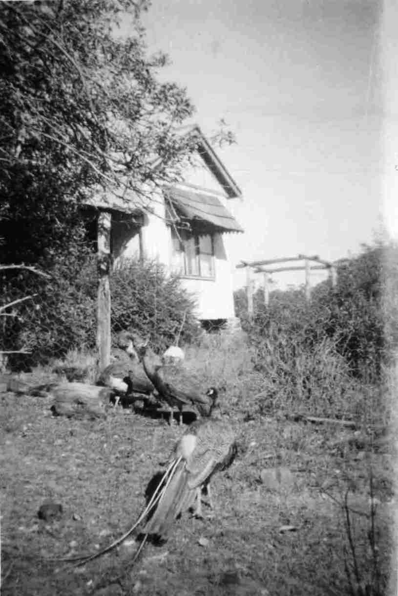
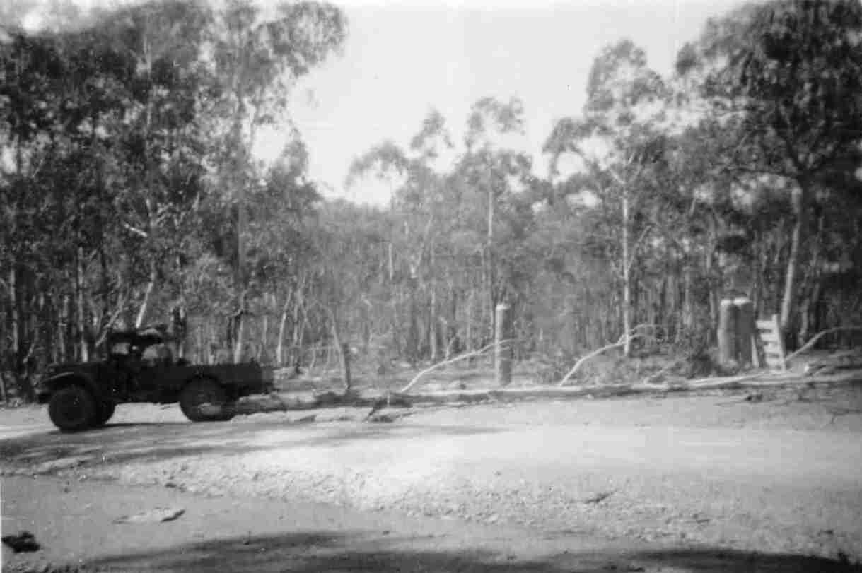
The photos displayed below are proudly supplied by the Brooks' grandson Mr James LUND. In dedication to the vision and hard work done by these brave early developers.
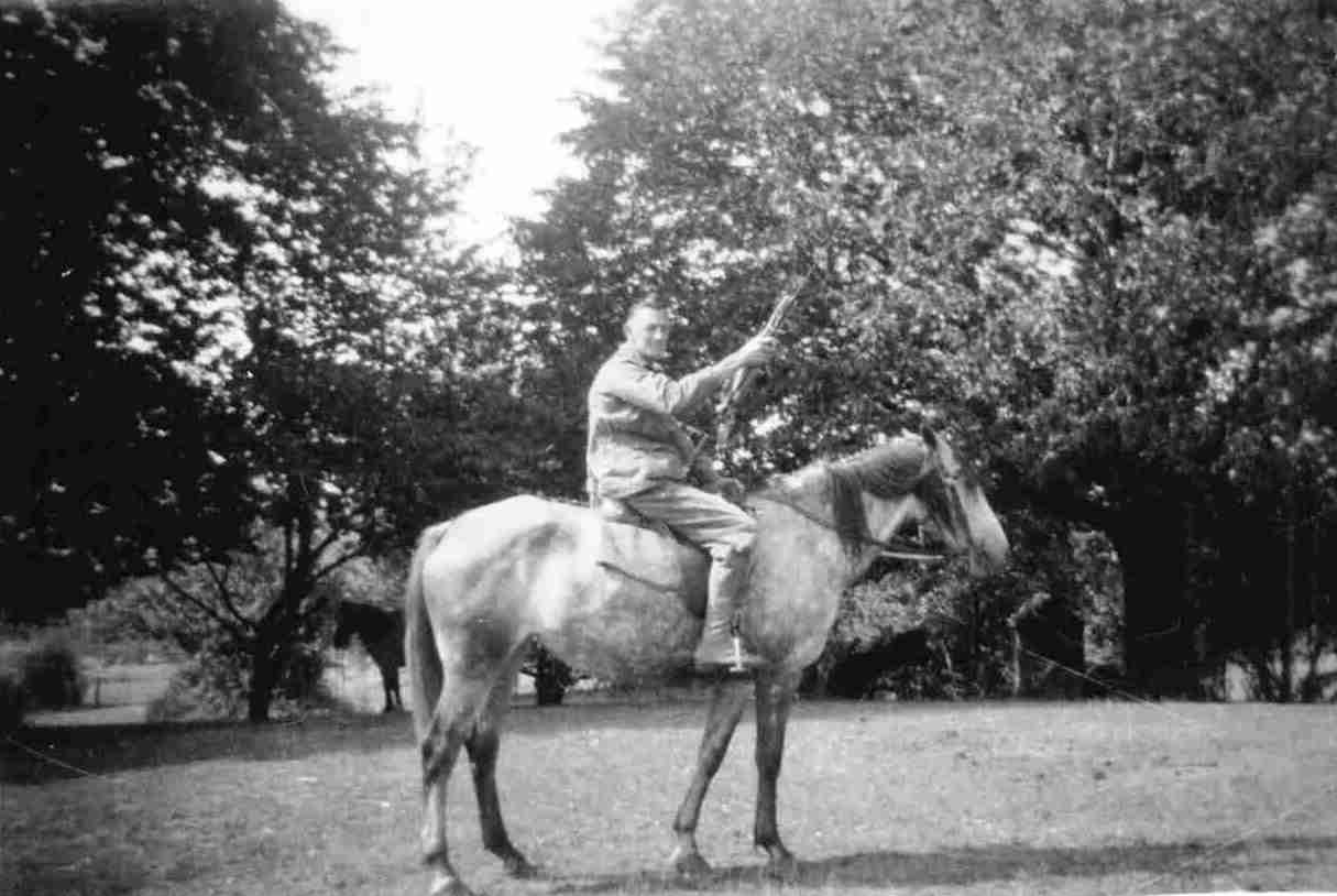
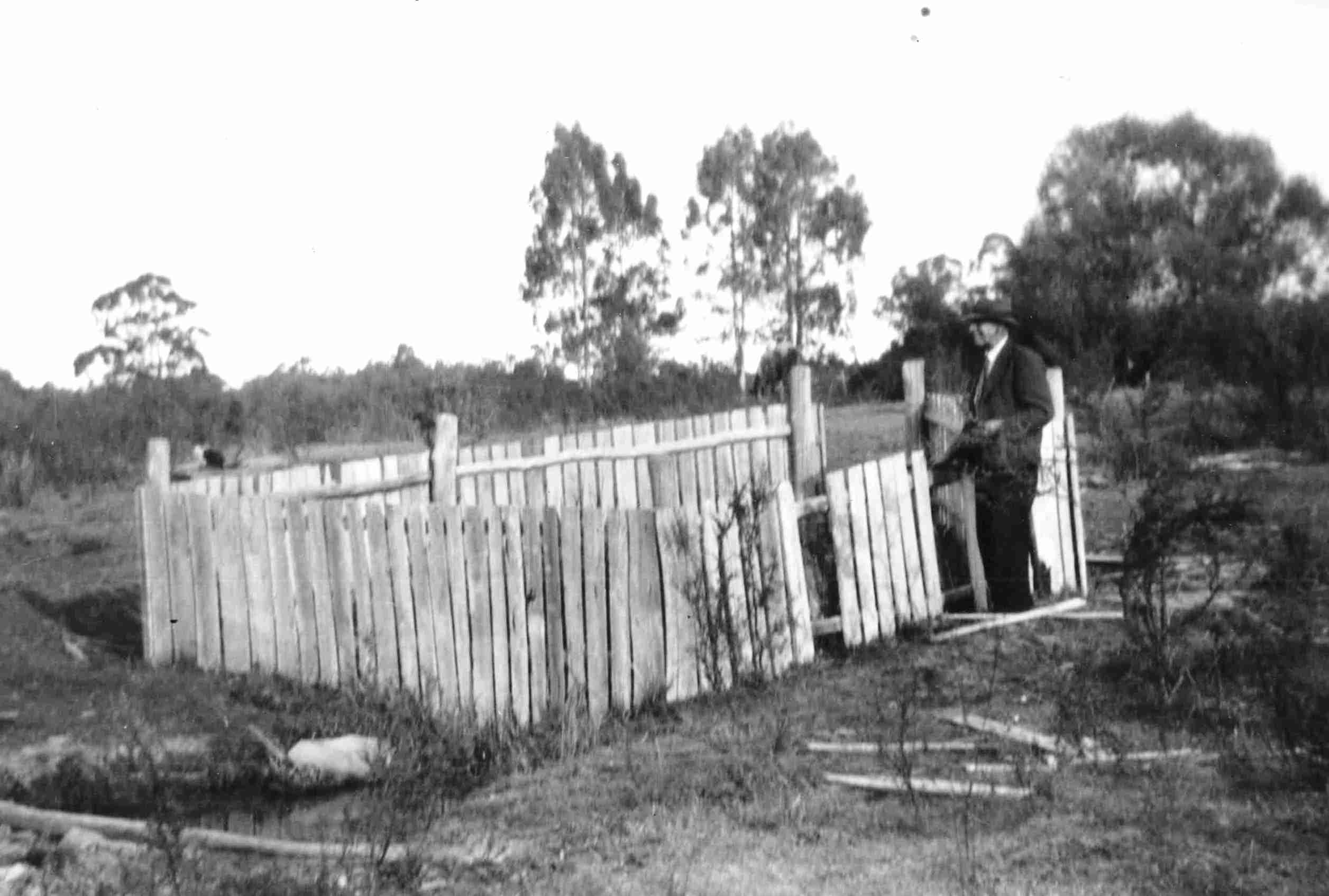
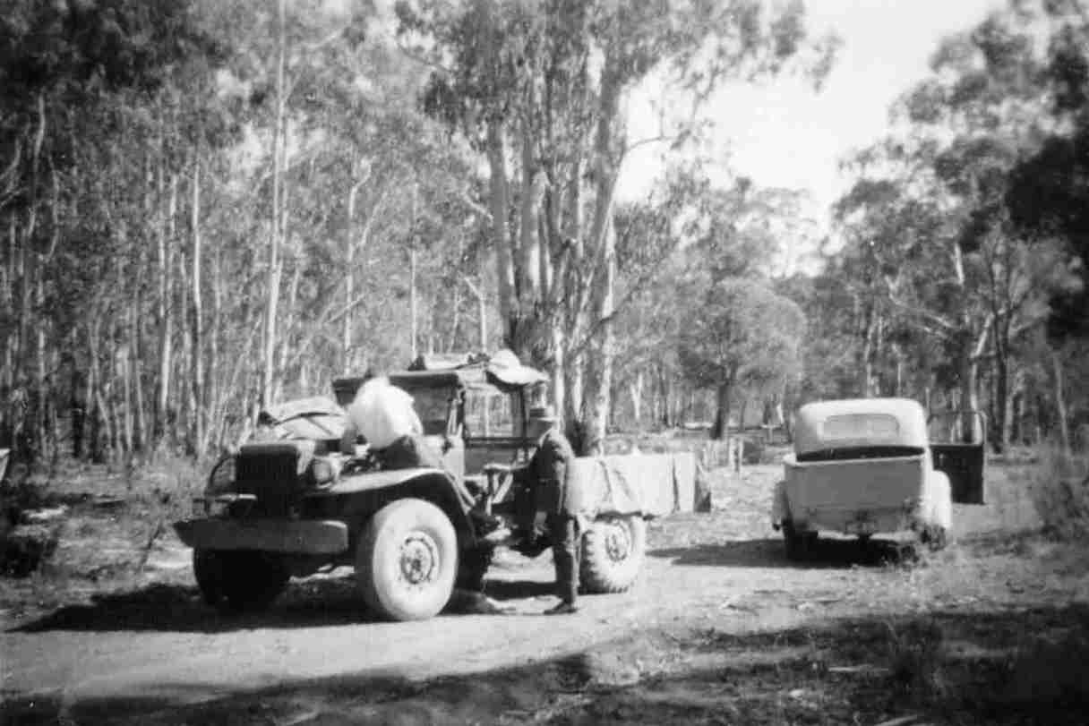
Bruce BROOKS
Mavis BROOKS
In 1943 she married Raymond Wesley Faulks - (Ref- NSW BDM 15859/1943).
In 1951 Eric Harold LUND married Mavis FAULKS (nee BROOKS) in TUMUT, NSW - (Ref NSW BDM 27622)
Country woman from South likes our sun, PRESIDENT of the Country Women's Association in New South Wales (Mrs. G. L. Brooks), visiting Brisbane for the first time to attend the C.W.A. conference, found yesterday's sunshine a happy change from the crisp cold of her own home — 4000 feet and in 'The Snow Country.'
Her sheep station-home, 'Jounama,' 40 miles from Tumut, is near the Yarrangobilly Caves. 'It is lovely scenery,' she said, 'and lots of visitors come there so we entertain a great deal.' Being State president keeps Mrs. Brooks very busy, and she admits she could not cope with the demands on her time but with the co-operation of her family.
She has a grown-up son and daughter at home, and her husband, fortunately, thinks that it is no use taking an a job without meeting all it's demands. Gardening and riding provide interests for her few leisure hours. Now in her third term at president. Mrs Brooks is delighted with the association in raising half of its objective of Ł60,000 for the building of two new seaside homes, for the use of members. The homes will be a gift to mark the Jubilee celebrated in 1947. New South Wales, she said, has an active younger set with a State leader. It will hold it's own separate conference this year. Of the 13 bush hospitals founded by the association some are now under the direction of the State Commission. The bush nurses help with others. There are seven school hostels, and the association conducts a students' club in Sydney with accommodation for 60 girls.- (Ref- The Courier-Mail (Brisbane, Qld. : 1933 - 1954)(about) Previous issue Monday 30 May 1949).
ATTENTION is directed to a notice in the Government Gazette of 31st July, notifying the Sale of SNOW LEASES to take place at QUEANBEYAN, COOTA, and TUMUT, on 7th SEPTEMBER, parishes Peppercurn, Murray, Cooleman, The Peaks, Yarrangobilly, Long Plain, Nattung, Nungar, Kiandra, Govandra, Tantangarn, Gurrangora, Guthega, Kosciusko, Mitchell, Bogoug, Jagunga, Bordig, Talbingo, Jounama, counties Buccleuch, Crowley and Wallace. WILLIAM HOUSTON, 5a 19 Under Secretary for Lands Roads Office, Quesnbeyan, 6th August, 1897. - (Ref- Queanbeyan Age (NSW : 1867 - 1904)(about) Previous issue Wednesday 11 August 1897).
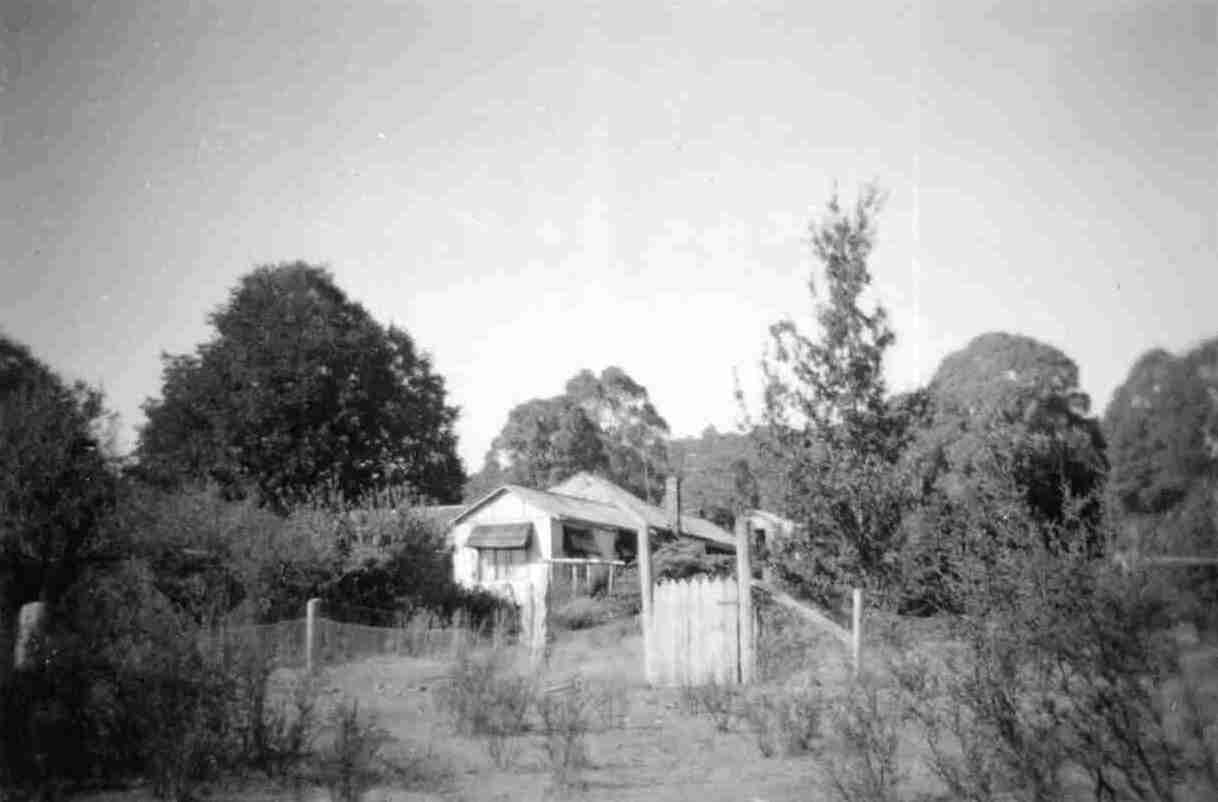
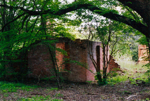
http://trove.nla.gov.au/picture/result?q=jounama - for additional photos of the station homestead ruins.
Jounama Homestead (4.8km) At the Blue Creek Trail there is parking for the 2.7km return walk to Jounama Homestead.
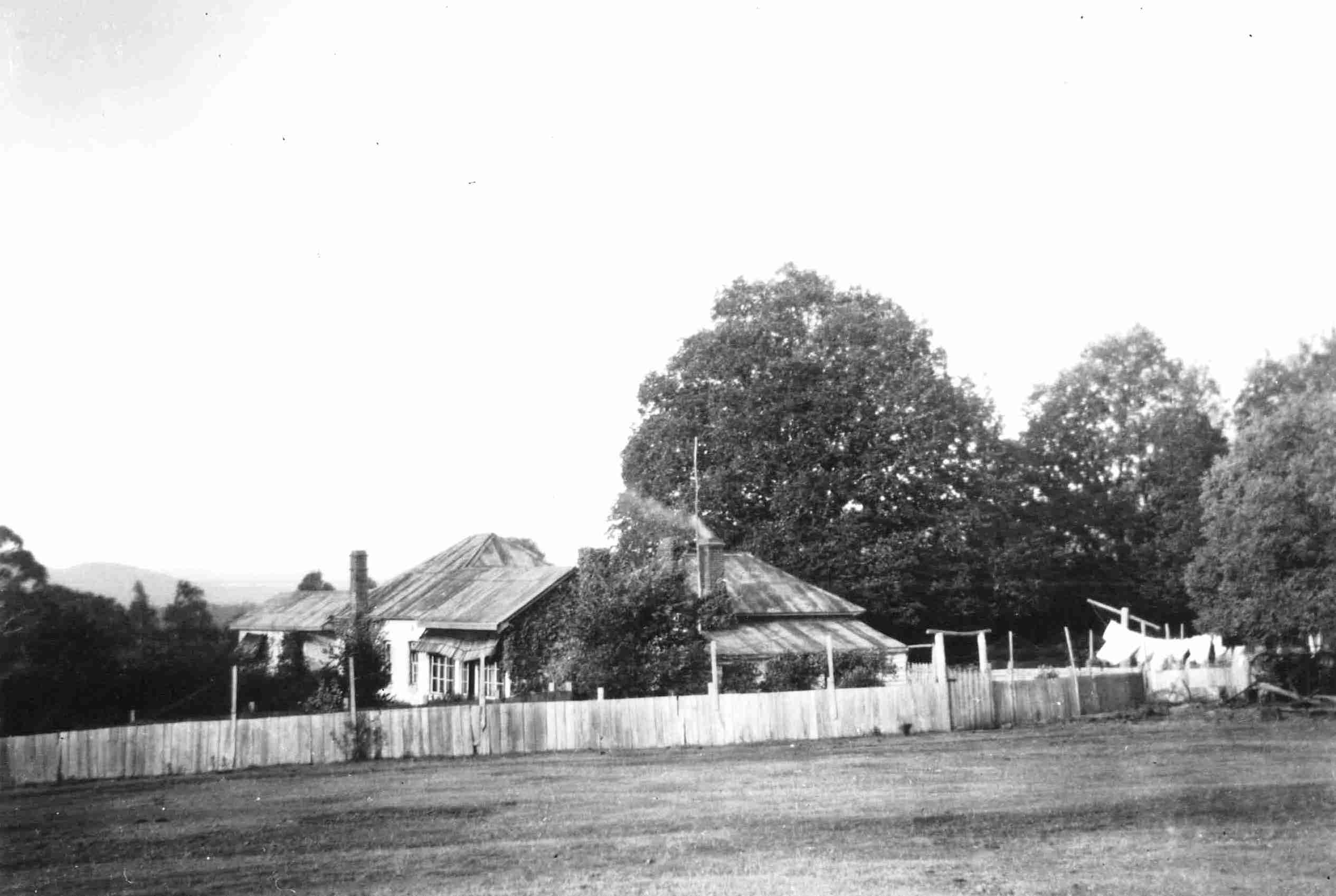
The Homestead was built from 1920 to the 1950s. It had seven rooms and was made of brick, timber and fibro. Most of the bricks were made on site and others came from the Ravine copper mine kiln and furnace. The front entry jasper flagstones are also from Ravine.
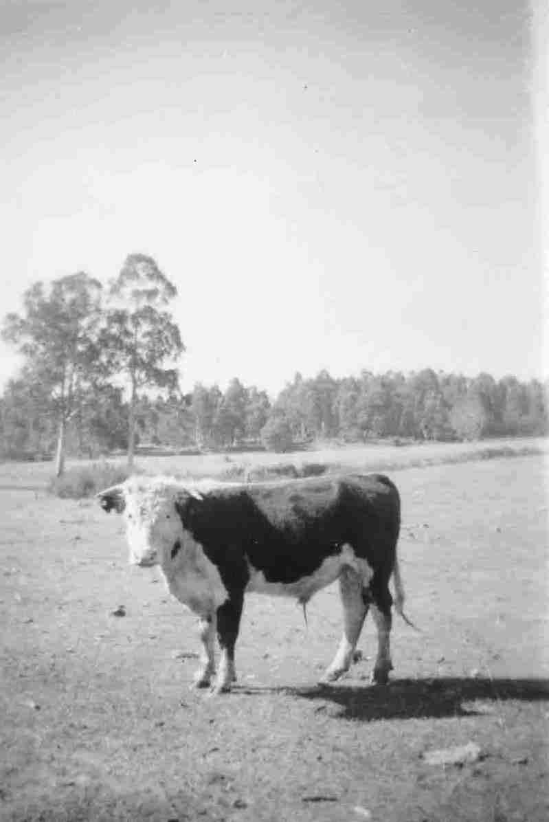
The homestead out-buildings and landscape included a buggy shed, chicken pen, stock yards and wool shed, and an English style garden.
Most of the homestead was burnt down in the early 1960s and useful materials were reused elsewhere.
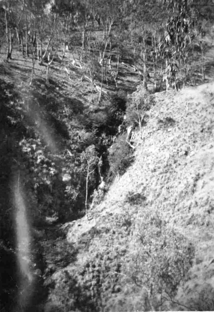
Lobs Hole Ravine Road (58.1km/41.9km) This unsealed road is suitable for 2WD access to Jounama Heritage Walk and Homestead Ruin. Beyond this point, a public access 4WD trail crosses Yarrangobilly River and joins the Ravine Road passing Wallaces Creek Lookout before it joins the Cabramurra - (Ref - http://www.environment.nsw.gov.au/resources/parks/southern/Kosciuszko_National_Park/3KosiGuide2012Drives.pdf).
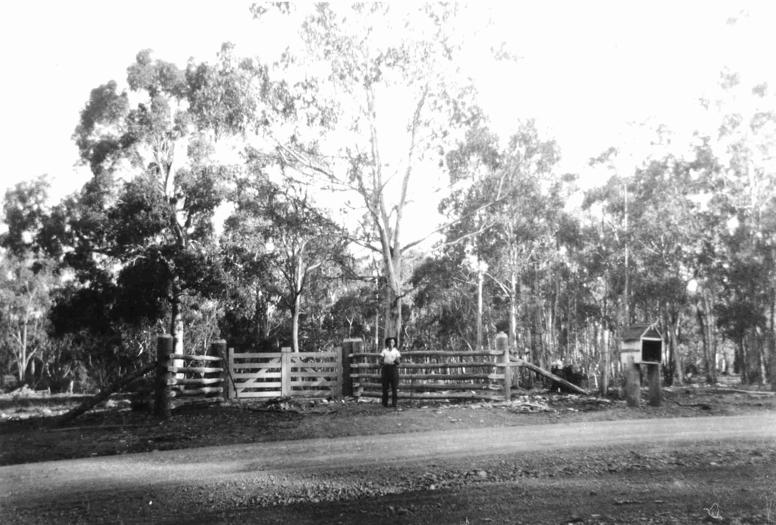
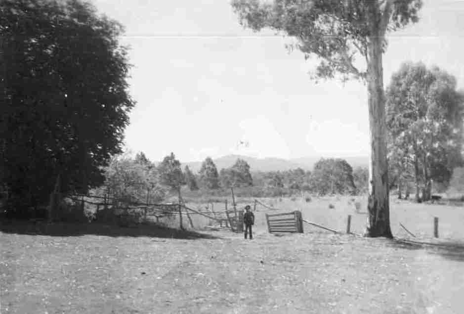
Lobs Hole Ravine 4WD drive This road leads to the site of an old settlement where copper mining took place. Cross the Yarrangobilly River and take in the views at Wallaces Creek Lookout. The road is four-wheel drive only between Jounama Homestead and Wallaces Creek Lookout. It may be closed at times due to weather. DISTANCES are given from the turn-off from the Snowy Mountains Highway 58.1km from Adaminaby and 41.9km from Tumut. Entrance Gates (0km) Just off the Snowy Mountains Highway are entrance gates to what was Jounama property which was made up of freehold land and periodic snow leases. The earliest documented settlement of this area is around 1858. Jounama School House site (250–300 metres) On the western side of the road. A step is all that remains and is signposted. Children walked or rode from local homesteads. Jounama Heritage Walk (1.8km) This is a moderate 3.2km return walk. There were several homesteads and huts within the Jounama area during the late 1800s and early 1900s. There are now two ruins—‘Glendella’ and ‘Faraway’. Both were once three bedroom homes. Further along, you can walk to other dwellings that existed. These include ‘Woodlands’ and the local butcher’s home.
Pinbeyan Range (12km) The Pinbeyan Ridge is clearly visible. From this point, views of the Yarrangobilly arm of Talbingo Reservoir appear as you descend into the valley.
Lobs Hole Ravine (approx 23km) Around 1842 bullock dray traffic travelled west of the ranges via Tollbar Ridge and Lobs Hole Ravine. This was the easiest route across the mountains to the west. Cattle duffers were also known to frequent the valley when moving stolen stock across the ranges.
In 1861 a boarding house was established to serve miners heading to the Kiandra goldfields. Miners also came seeking milder conditions in winter. In 1874 copper mining began in the Lobs Hole Ravine area. Between 1890 and 1902 copper production reached its peak.
Production fell due to mine gas, shaft flooding, fluctuating market prices and transport costs to the Gundagai railhead. By 1910 the Lobs Hole area had an established village which was finally renamed Ravine. Lobs Hole is actually located below Sheep Station Ridge now under water.
There was a school, butcher, police station and blacksmith to service the farm and mining community surrounding the area. Washington Hotel was opened in 1909, catering for miners and travellers crossing the mountains to Kiandra. The building is significant because it was one of the largest rammed-earth structures of its day.
By 1919 all mines were abandoned which brought about a speedy decline in residents and services.
By 1920 the Yan family, associated with Yan’s Store in Kiandra, were the only residents of the area. Most buildings that remained in the area succumbed to fire. The last burnt down in 1964. However, the Washington Hotel was sold in 1923, and all materials (except the pise walls) were removed to Humula.
In the 1960s the Lobs Hole Ravine Road was constructed during the development of the Snowy Mountains Hydro-electric Scheme. The area became a popular place for camping and was incorporated into Kosciuszko National Park in 1986. Block Stream (Boulder Field) (approx 31km) This is an example of a basalt blockstream formed in the last ice age. Such ‘periglacial’ features are formed from repeated freezing and thawing.
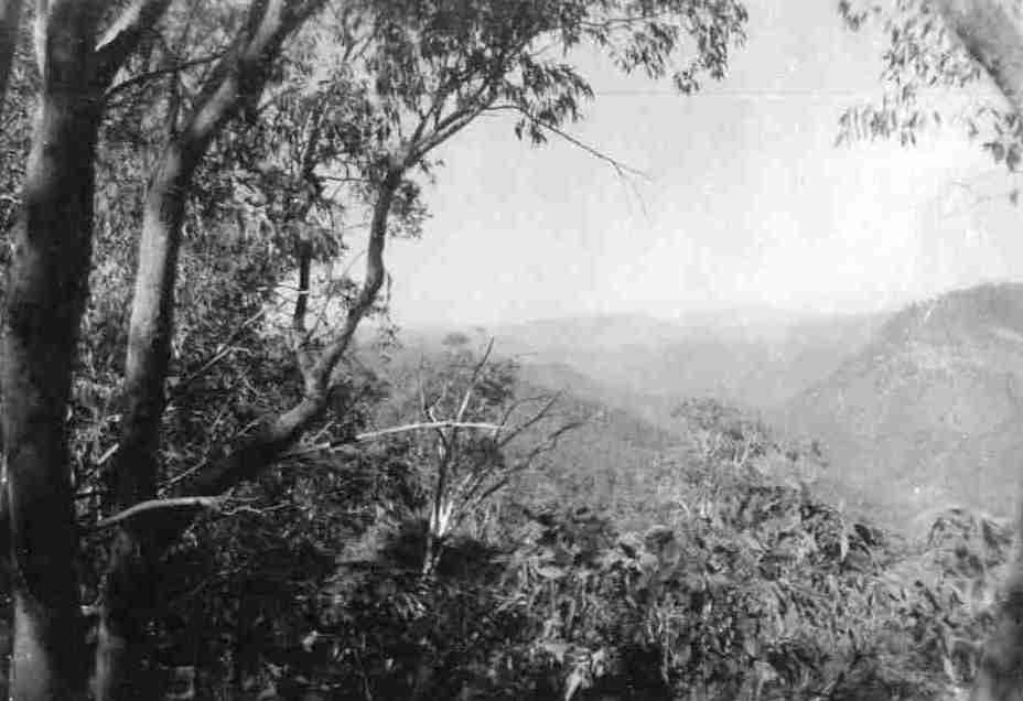
Wallaces Creek Lookout (35km 1310 metres above Lobs Hole Ravine 4WD drive This road leads to the site of an old settlement where copper mining took place. Cross the Yarrangobilly River and take in the views at Wallaces Creek Lookout.
The road is four-wheel drive only between Jounama Homestead and Wallaces Creek Lookout. It may be closed at times due to weather. DISTANCES are given from the turn-off from the Snowy Mountains Highway 58.1km from Adaminaby and 41.9km from Tumut. Entrance Gates (0km) Just off the Snowy Mountains Highway are entrance gates to what was Jounama property which was made up of freehold land and periodic snow leases. The earliest documented settlement of this area is around 1858. Jounama School House site (250–300 metres) On the western side of the road. A step is all that remains and is signposted. Children walked or rode from local homesteads.
Jounama Heritage Walk (1.8km) This is a moderate 3.2km return walk. There were several homesteads and huts within the Jounama area during the late 1800s and early 1900s. There are now two ruins—‘Glendella’ and ‘Faraway’. Both were once three bedroom homes. Further along, you can walk to other dwellings that existed. These include ‘Woodlands’ and the local butcher’s home.
Jounama Homestead (4.8km) At the Blue Creek Trail there is parking for the 2.7km return walk to Jounama Homestead.
Pinbeyan Range (12km) The Pinbeyan Ridge is clearly visible. From this point, views of the Yarrangobilly arm of Talbingo Reservoir appear as you descend into the valley. Lobs Hole Ravine (approx 23km) Around 1842 bullock dray traffic travelled west of the ranges via Tollbar Ridge and Lobs Hole Ravine. This was the easiest route across the mountains to the west. Cattle duffers were also known to frequent the valley when moving stolen stock across the ranges.
In 1861 a boarding house was established to serve miners heading to the Kiandra goldfields. Miners also came seeking milder conditions in winter. In 1874 copper mining began in the Lobs Hole Ravine area. Between 1890 and 1902 copper production reached its peak. Production fell due to mine gas, shaft flooding, fluctuating market prices and transport costs to the Gundagai railhead. By 1910 the Lobs Hole area had an established village which was finally renamed Ravine. Lobs Hole is actually located below Sheep Station Ridge now under water. There was a school, butcher, police station and blacksmith to service the farm and mining community surrounding the area. Washington Hotel was opened in 1909, catering for miners and travellers crossing the mountains to Kiandra. The building is significant because it was one of the largest rammed-earth structures of its day. By 1919 all mines were abandoned which brought about a speedy decline in residents and services. By 1920 the Yan family, associated with Yan’s Store in Kiandra, were the only residents of the area. Most buildings that remained in the area succumbed to fire. The last burnt down in 1964. However, the Washington Hotel was sold in 1923, and all materials (except the pise walls) were removed to Humula.
In the 1960s the Lobs Hole Ravine Road was constructed during the development of the Snowy Mountains Hydro-electric Scheme. The area became a popular place for camping and was incorporated into Kosciuszko National Park in 1986. Block Stream (Boulder Field) (approx 31km) This is an example of a basalt blockstream formed in the last ice age. Such ‘periglacial’ features are formed from repeated freezing and thawing.
Wallaces Creek Lookout (35km 1310 metres above sea level) There are extensive views of the Great Dividing Range, Yarrangobilly river and valley and Big Talbingo Mountain. The parking area is 2.2km from the Kiandra to Cabramurra (Link) Road. The platform is 40 metres from the parking area and is suitable for assisted wheelchair access.
Kiandra to Cabramurra (Link) Road (37km). Turn right to Cabramurra, Tumbarumba and Khancoban or left for Three Mile Dam and the Snowy Mountains Highway.
For more information visit www.nswnationalparks.com.au
To Yellowin To Yarrangobilly - To HOME