THE
BEAUTIFUL BLOWERING
VALLEY
south of
south of
"This Web page is dedicated to the Early Pioneers from 1824 through to the final days and the Resumption & flooding of the Blowering Valley in about 1966.About 142 Years Of History Is Available for Rediscovering And Filing In Honour Of These Brave People, Who Took On The Elements And Won All, BUT THE LAST FIGHT ~"
to the RESUMPTION of the valley in about 1966
by

John standing beside his painting named "Low Tide At Blowering During Drought !!!"
On the 21st March, 1952, some 15 acres of land from Portion No.... at a fee of Pounds...... was resumed from Mrs B E Long. To establish an Office - Store - Workshops - Camp - Housing for the preparation to commence construction of the "Blowering Dam".
The establishment of the work site plus investigation drilling and soil testing was carried out until 1957 when due to lack of finance work was stopped temporarily. It did not recommence until 1963 when the decision was made to have the Snowy Mountains Authority build the Blowering Dam as agents for the Water Conservation and Irrigation Commission (W.C. & I.C.).The W.C. & I. C. was given the responsibility of administration of the Land Resumptions.

Looking up the

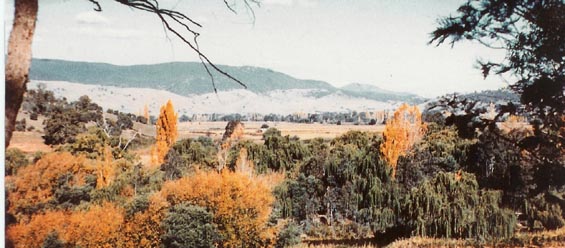
A pretty good view
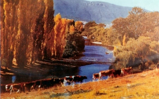
for "The Girls", whilst out walking in the sun beside the
See the Blowering Cliffs in the background.

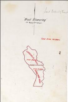
Early Blowering Map
~~Local Areas, who had a connection with the "Blowering Valley".~~
Adelong ,
Ardrossan, Argalong, Adjunbilly
, Back Creek, Bangadang, Batlow , Billapalap, Bimberi, Black Creek, Blowering, Bongongo, Bombowlee , Bondo, Brungle, , Buddong, Cabramurra, Califat,
Cooleman, Cooleys Creek, Cornishtown , Courajago, Darbarlara , Darlow, Ellerslie, Franklin, Gadara, Gilmore , Gocup , Goobarragandra,
Grahamstown, Hillas Creek, Jones's
Bidge ,
Kiandra,
Killimicat,
Kunama, Lacmalac, Long Plain, Lower Bago, Midway, Minijary,
Mount Adrah, Mount Horeb, Mundongo, Peels Creek, Pinbeyan, Ravine Springfield , Talbingo, Tanyard
Creek, The grove,
Tumbarumba ,
Tumorrama ,
Tumut,
Tumut Plains ,
Wee Jasper , Wereboldera, Wermatong , Westwood,
Windowie ,
Wondalga, Wyangle,
Wagragobilly ,
Yarrangobilly , Yaven Creek and
Yass.
Yellowin.
Some great "LINKS"
.
~EXTRA TOPICS~
Aborigines,
Births,
Bridges ,
Chinese farmers,
Churches ,
Convicts,
Dam development,
Explorers ,
Governors ,
Land Definitions ,
MIA ,
Maps ,
Marraige ,
Mountains,
Runs ,
Schools
"Robertson Land Act",
Thank you list ,
Time Line ,
Tumut Index ,
Some great "LINKS"
.
|
|
| Counter provided by web design company online directory. |
This Site Last Updated = 9.4.11